
Its’ been a while since my last post, I have been out doing some adventuring but I still remain several years behind on sharing stories and imagery from my journeys. The South East received a lot of rain this past week, making it a great time to check out waterfalls. I went to North Carolina, just north of South Carolina and very close to Georgia, because Transylvania County, NC is known as the Land of The Waterfalls. I got to see six waterfalls and hiked between eight and nine miles during my day of adventuring. All the falls I visited were off Highway 281(this road is also 130 in SC but becomes 281 as you enter NC.) The trails I visited are all found off of an eight miles section of this road. There were also more falls along this section of road to visit then I saw during this trip.
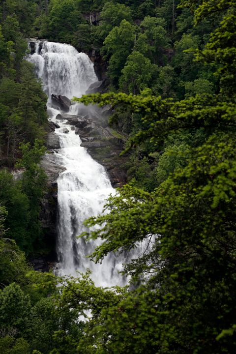
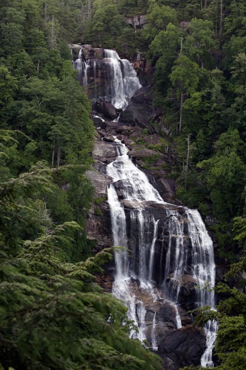
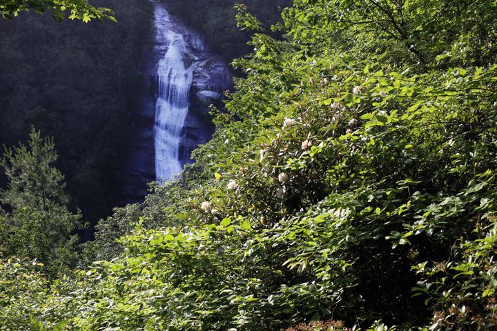
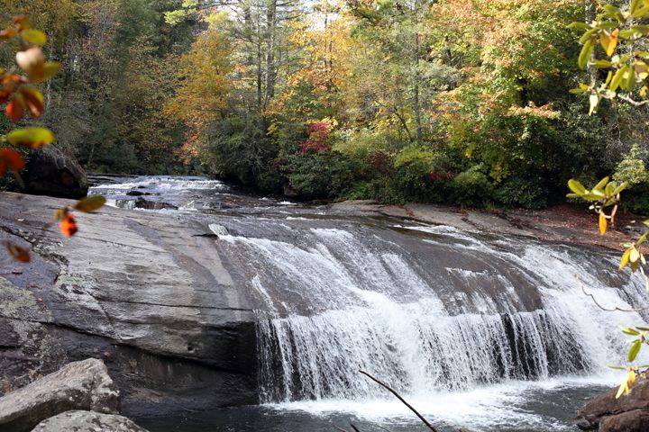
My first stop was Whitewater Falls. This parking area is right off the road. They charge a $2 fee to park, if I had remembered my national parks pass, parking here would have been covered. It is a 1/2-mile hike to a viewing area of the falls. There is a mostly flat paved path in the beginning and then you have to go down quite a lot of steep steps to reach the lower viewing point, you can view the falls from the upper viewing area but its worth it to go down the steps. The waterfall was raging and had a lot more water then when I have visited before. Check out the photo comparison from two different trips below. Total hiking distance there and back is one mile.
6/3/18
6/13/15
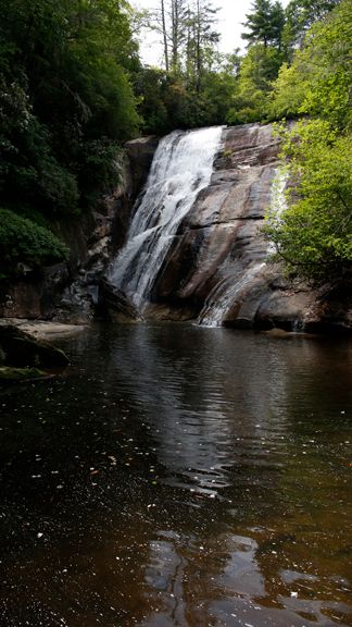
The next stop was High Falls, which is off of Brewer road on the right a few miles down the road form Whitewater falls. The trail is up in the woods to the right from the top of Brewer rd starting just past the forest service road gate. It is a mile and a half walk one way from the parking area to the falls. You hike downhill for a while the trail was actually a tributary to the creek with water flowing down it during part of my walk down the hill. You hang a right when you have a choice to continue straight or go right at a trail juncture. When you get to the next trail junction you go left down towards the sound of the falls. When I got to the bottom I discovered that the creek was too high and moving too fast to cross to be able to see the falls or get to the swimming hole. It would be best to avoid this hike if the area has been receiving a lot of rain. The photograph from my previous trip when you could cross over to the falls does not really portray the beauty or give the best representation of this waterfall. There is no substitute for seeing a place with your own eyes.
7-9-17
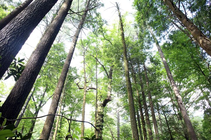
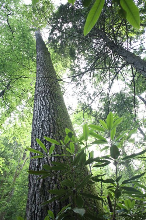
The temperatures were not too bad for my day in the mountains. I think it was in the high seventies maybe low eighties but it was very humid. I was hoping to have been able to go swimming. One bonus on this hike was that I did not see anyone else on the trail. Had I gotten to swim here I would of driven back down the road into South Carolina and gone hiking to Lower Whitewater Falls and the Coon Branch Natural Area. Duke Power owns this area, the Bad Creek Hydro Electric Station is here. You can hike 1.5 miles one way via the Bad Creek Spur and Coon Branch Trail to a 20-acre virgin forest with large hemlocks and many large hardwood trees. The tree canopy is absolutely amazing and I can't think of another tree canopy I have seen that is like it. Some photographs are below but they don't even begin to portray the area. You can also hike to Lower White Water Falls from this parking area. It is 1.9 miles one-way to hike to a viewing platform of these falls. You are a long way above the falls from the viewing platform, considering the hiking time involved upper whitewater falls offers the better waterfall view with less effort.
6/13/15
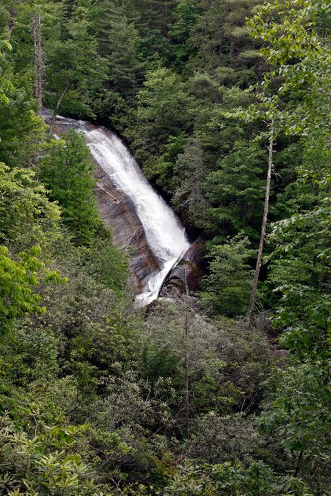
I did really want to go swimming so I continued up the road from High Falls to nearby Gorges State Park. Here the Horsepasture River offers you the opportunity to hike to seven waterfalls mostly within this park. I saw four of the seven during this trip it is 1.5 miles one way down to Rainbow Falls. You can then continue upstream to Turtle Back Falls and Bust Your Ass Falls, the last one now bordering on private property. The first time I visited these falls was twenty five or more years ago as a kid with my parents. At that time Gorges State Park did not exist and you walked off the road down to the falls. I returned here for the first time since being a kid in the fall of 2014.
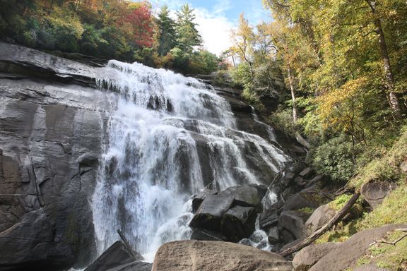
10/11/14
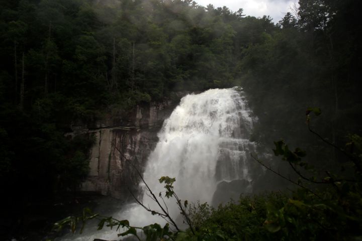
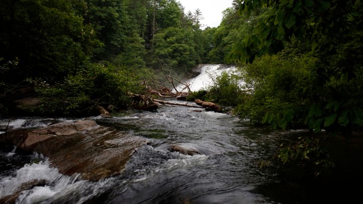
This trip was my third trip here since then. This time there was so much water was coming off the falls it was very difficult to get a picture because the camera and I were both getting sprayed with water. My photographs do not display the power of the water or the strength of its current. You don't want to go over rainbow falls, unfortunately people have and died. You can stand on the rocks at the top of the falls, just don't venture on to wet rocks above Rainbow Falls.
6/3/18
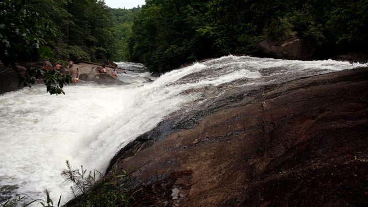
I am guessing its another half a mile or more upstream to Turtle Back and Bust Your Ass Falls.(As a side note people use to slide down Bust Your Ass Falls, I remember seeing it as a kid, but access to do so is now on private property. You can usually swim at and around Turtle Back Falls but the current made swimming in the usual spots not such a good idea. I saw a couple of crazy dudes trying it anyway. The one guy I saw in the water was struggling to get back to where he must of jumped in and his buddy was inching along the side of the rock to try to help him out. I didn't stick around to see how this progressed. It looked like to me that you could have easily jumped in and then just gotten spun around in a circle by the water for a while. Below the falls there was a place to safely swim but there were multiple families there with their kids enjoying it already so I continued upstream to look for another swimming spot.
Turtle Back Falls 10-11-14
6/3/18 I don't think these were the dudes I saw trying to swim here. Also the pictures are not accurately portraying the turbulent nature of the water.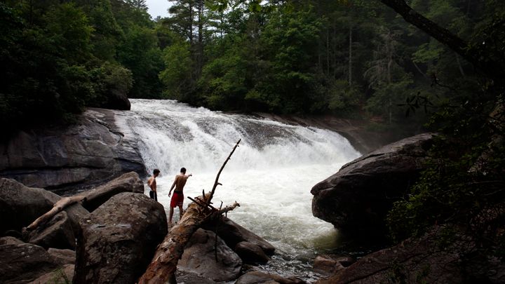
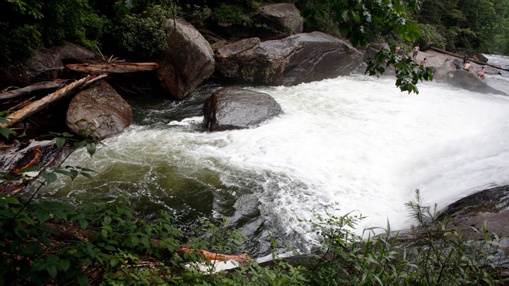
I didn't find a place to swim by Bust Your Ass Falls, which was a little further upstream, instead I just dunked my head in the water to cool off.
On the hike back the families at the previous swimming spot were headed out so I did finally get to fully submerge myself in the water for a few minutes. I thought back to the conversation I had with Mark Johnson, one of the two slide guitar players in the Atlanta based band Delta Moon, on Friday night. Steve Baird and I got together with Mark and played some music and I got to play several of Mark's nice guitars. Mark told us that he had been in the habit of taking cold showers or submerging himself in ice water everyday for a while as a way to rejuvenate the body and that he had been feeling great as a result. We talked about jumping in mountain streams that are so cold they take your breath away. I am not sure I am ready for ice cold water on a daily basis but I will jump in a mountain stream in the summertime and I find it both refreshing and rejuvenating.
I felt pretty good hiking back up to the parking area from the falls. I did take a break during the walk up but I still passed several groups of the same people more than once as I hiked to the top and these were people who started up before I did. To their credit at least half of them were walking with or carrying their children.
The visitors center at the park is nice as well, in addition to clean facilities and useful information, there are several views of the surrounding mountains. I was going to check out the views after stopping at the restroom but there was a guy walking around in circles around the visitor's center area, which i thought, was a little odd. This was the only other person around besides me at that time so I continued on to another part of the park to try to catch some views of the sunset. For some reason I had trouble finding the overlooks I had seen the last time I had been here. I did find a viewpoint I had not seen before and I hiked down to Bearwallow Falls.
After getting back from that the sun had set and twilight was all that was left so I got back in the car to head home. I stopped at the visitors center again on the way out but that guy was still circling the building and I decided against using the restroom there before leaving. It was nice to have a little bit of dwindling light to see to drive down the mountain with. I like having a little light to see on those curvy mountain roads better than just the headlights cutting thru the darkness. I got to see a nice display of fireflies in the twilight along the side of the road on the drive down. Once I made it down to flatter ground I saw a wicked thunderstorm off in the distance on the drive home. When the lightning flashed there was this wicked sinister pink light that filled up they sky illuminating eerie dark clouds. I don't think I have ever seen a storm have those particular colors. It made me think of the H.P. Lovecraft story "The Haunter of the Dark". If you like horror stories you should read that one sometime.
I felt great before, during, and after my day of hiking adventure. I will eventually be a little sore from all that up and downhill hiking but I think it was well worth it.